Saturday, November 24, 2012

Pace Lake Road (Part 1)

-->

Pace Lake  (part 1)

10/05/2008
By Jerry Smith
 
The Pace Lake road was one trip I had been looking forward to trying. 

   
This wash on the Pace Lake Road is an off-camber, narrow climb.
The maps showed it as a fairly short trip from Grand Junction down Hwy 141 and south of Gateway another 10-miles or so. 

Just across the bridge that crosses Salt Creek is a "Historical Marker" about Sewemup Mesa. 

It tells about Sewemup Mesa that stands hundreds of feet behind and above the sign being a Wilderness Study area and a little history of the area.


 This is the corner with the big boulders (not visible in this picture).
It seems that cattle rustlers once used the area to hide their stolen cattle.  Back in the Sinbad Valley behind Sewemup Mesa, they had a large natural holding area.

There they would surgically remove the old brands from the cattle and then "sew up the wound" (Sewemup) before later re-branding the cattle.  (Anyone need a tattoo removed?)

Recrossing the bridge and taking a left turn up the Salt Creek road took us (Happy Trails and I) into the Salt Creek Canyon. 


 Note the point of the rock near the rear passenger tire.  It eats tires and wheels.
This is a deep, narrow canyon with nearly vertical red sandstone walls on both sides.  To say it's a "spectacular canyon" is unworthy of the magnificence.

Salt Creek crosses the road twice as you travel up toward Sinbad Valley.  The white high water mark was very easy to see.  

Just days before there had been a serious rain in Sinbad Valley.  The resulting "gully washer" had been between three and four feet deep and the road crews had already been there to reopen the road, but the "WARNING" was still very evident.

When Jeeping in canyon country, one must be cognizant of the area weather.  Not just straight above you either. 


 Rocks of this size are common on the Pace Lake Road.
Sometimes the water in these canyons travels a long way from the source as a flash flood.  Sinbad Valley is a giant bowl with 800 - 1400 foot high, near vertical cliffs surrounding all but the Salt Creek canyon. 

Salt Creek is the only way in or out of Sinbad in a vehicle. 

Sinbad Valley once was a small salty sea that dried up leaving a salt dome the width of the valley.  It is thought that the weight of dust from Utah's southern region eventually collapsed the salt dome. 

This helps explain that the water going down Salt Creek is about 2/3 as salty as seawater.  The creek bottom turns white as the creek recedes and dries. 


 Cody is obviously nervous about the side of his Grand Cherokee.

After entering Sinbad Valley and about half way to the foot of the mountain toward Pace Lake, the road had signs of what it would be like if real wet. 


One track or the center of the road was cut up to 24" deep with near vertical walls snaking back and forth across the road from rain runoff.   


The clay-like surface was still just damp and it built up in the tires enough to limit traction to near nothing.  Being here while it rained would be "really dumb".


Staying out of the deep channel was a full-time job but soon the elevation changed enough that there was a river rock-like surface that was "slow-going" and very rough.


Nearing the bottom of the mountain the road splits.  As the general direction toward Pace Lake was to the right, we (Happy Trails & I) took the right fork.


In about 200 yards, we came to the remnants of an old log cabin.  The current resident (a lizard) ducked for cover as I rummaged around taking pictures.


Back on the road, we immediately began a steep climb.  Another 100 yards brought us to a bad scene.   


The lower side of the road no longer existed.  It was a deep, wide channel at least 3-4 feet deep and about as wide.


After walking up the road nearly a quarter mile, I determined that this way was not going to be passable without some serious excavating.  We backed down to the cabin and turned around for a look at the other fork.


This fork of the Pace Lake road circled the foot of the mountain with another fork to the left along the way. 


Staying right, we came to a wash that looked intimidating.   


The close bank was almost 5 feet straight down and then the climb out began exactly at the foot of the mountain.   No hill for a climber.


After "jumping" the wash, we began climbing the Pace Lake road.  


The road narrows as you go with deep V-cuts in the lower side from runoff and many large rocks scattered from the hillside above littering the roadway.


The first mile or so required nearly two hours of work moving rocks over the side or into the V-cuts to slow the erosion.


 This part of the Pace Lake Road is where the first downfall tree was removed.

The Pace Lake road had been closed by Mother Nature for at least two years according to the BLM.  I wasn't sure what to expect, but I had a goal in mind that drove me onward. 


A little way up the mountainside an old burn is still evident.  Old burnt Juniper and Pinon Pine trees still stand though many have fallen or are about to. 


Coming to a fork where the eroded road from the cabin intersects, the Pace Lake road begins a steep climb.


There was a large burnt fir tree across the Pace Lake road blocking progress just above the intersection.  I got out to see about removing the tree when I looked up and saw a terribly black storm cloud rolling over the mountain above in the direction of where Pace Lake would be.


Having the knowledge of what rain meant to the Pace Lake road and the creek below, it seemed like a very good time to get out of there.   


By the time we hit the bottom of the mountain it had begun to rain.  This was not good.


Long before we got to the clay portion of the Pace Lake road, rain had thoroughly wet it making it exactly slick.   


Staying clear of the deep cut was difficult, but we were doing well... until a large rock protruding up from the right side of the road left only inches between the left side tires and the deep ditch.  Add to that the off-camber leaning toward the deep ditch tripled the danger on the Pace Lake road.


After 4 unsuccessful attempts to get by the rock, we slid into the ditch and became high centered with the axles firmly on the ground.  Bummer!  Pace Lake had just become very difficult.


As it was raining hard, I decided to wait for the storm to pass (I hoped).  After a half-hour it let up enough to get out without becoming too wet and cold.


After a quick assessment of the situation, out came the winch line to a nearby tree on the Pace Lake road and soon the recovery was over.  Luckily the creek had not swollen and we left the Pace Lake road for another day.


 If you have enjoyed this, please “Like” it on FaceBook and spread the word about it to your 4-Wheeling friends.  Let them know about the Pace Lake Road.

 NOTE:  Most of the pictures here were taken on other trips.


One last thought; when you come to a fork in the road…  take it!


Happy Trails to you.

(continued in Pace Lake {part 2}


Copyright 2008- 2012, all rights reserved


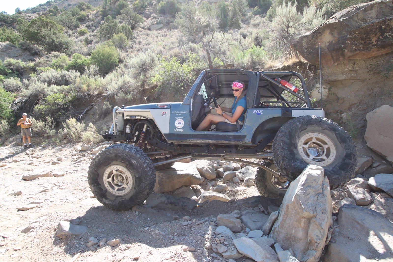
21 Road JP Magazine Photo Shoot

-->
21 Road JP Magazine Photo Shoot Run
July 11, 2012

By Jerry Smith

At the invitation of Wally Sheata, 8 members of the Grand Mesa Jeep Club and Mary Burns in her Buick showed up at the Acorn Truck Stop for a day of Jeeping 21 Road.  Mary bowed out (no tow hooks) but the rest were eager to hit the trail.


 photo-op at the 21 road parking area

The major reason for this trip was that Pete Trasborg of JP Magazine was in town to do a “shoot” for an article in some upcoming issue of JP Magazine.  Of course he was looking for Jeeps to photograph as the magazine is about “Jeeps”.

Dale showing off some of the "flex" in her Jeep
After a photo-op at the 21 road parking area, we all headed into Hunter Canyon as it is known to the BLM.  This trail is something hard to explain.  It is primarily a wash that runs heavy during the spring runoff and after significant rainstorms in the "Book Cliffs" in the drainage to the north of the mouth of Hunter Canyon.

The thing that makes it difficult to describe is the fact that after most storms of any note and definitely after/during the spring runoff, many changes take place as rocks and sand move around changing the trail… often in major ways.  The line you take one trip may not exist on the next trip.


Levi working over-time in the rocks of 21 Road

When flooding, this would be nowhere you’d want to be.  Standing in a deluge could literally be dangerous to your health.  Sand and silt would be the minimum you could expect to wear against your skin.

The real problem would be if you were in the path of one of the larger rocks being pushed by the large volume of water.  A broken leg would likely be the minimum outcome.


Ross carrying a 35" wheel on 21 Road

21 Road is known nationally by many of the Jeeping public.  Wheelers come from all over the map to run 21 Road.  The trail is a big hit with the annual Rock Junction event put on by the Grand Mesa Jeep Club. 
And yet there is a significant move by Preservationists pressuring the BLM to make this a “Roadless Area”.  How this makes sense is a mystery, but when it comes to land use policies of public land management, mysteries seldom have a happy ending if you’re into motorized sports.


Roy's CJ making 21 Road look easy on 35" tires

That having been said, once you dive off of the road into the wash, it won’t be long before you realize why this trail has a high rating with the Daily Driver and Buggy classes.  If you want a challenge you don’t have to look far.


 Wally took nearly every "hard line" 21 Road through at us.

The lines you choose in several places along this trail are enough to make a rig on small tires or up to 40”+ tires wonder about the final outcome of their choice.  Yeah… this trail has it all.

With all the difficulty comes with a fair amount of damage and broken running gear.  As you negotiate 21 Road you will see scars on many, many rocks.  Those scars are from the undercarriages of many adventuring individuals who were either slightly off-line or were simply too low to miss that rock.  


 Grand Mesa Jeep Club President Jeff Bates showed off his new "Patina" look with some "crawling" of his own.

You’ll see those scars on rocks above your head so it’s not always low ground clearance at fault.  Many have used their roll cages to keep from tipping over on some places.


Cody dropped out after a rock "tapped" his rocker panel rather hard.

Our group had tires from 33” to 43” diameters and all rigs left their “sign” of having passed by the end of the day.

Speaking for myself, my 33” tires lost traction in more instances than I can remember.  In one place it took three people bouncing the front bumper to find enough traction to get my rear differential free of one rock.

One other “situation” required pulling out the winch cable for further progress.  That “situation” is where the rear license plate and the plastic mount became “wrinkled”. 

Other damage included Cody’s Grand Cherokee passenger side rocker panel.  One large rock jumped up and smashed into it leaving a deep dent.  The rocks can be vengeful when abused by passers-by. 

We all witnessed some great driving skills on this trip.  For those who seldom witness true rock crawling, watching Wally, Jeff, and Dale was a lesson in what “drives” them to the extremes. 


 Wally showed how to crawl a 20 ft. vertical wall (behind the Jeep) horizontally.  He's about 10 ft. up it here.

Places we of the “small-tire” group wouldn’t even consider were negotiated with great skill.  The flexibility, capability, and power of the rock crawling buggies is nothing short of incredible.

Even with all the wear and tear of the day, back at the parking area near 4PM we were all wearing smiles.  This trip will have memories for each of us and if all goes well we will all relive some of it in JP magazine.

Many thanks go to Wally and Pete for allowing us the opportunity to experience 21 Road and the possibility to be seen in a national magazine. 


 Wally again showing a horizontal - vertical rock crawl on the side walls.

The experience alone was well worth the effort.  The anticipation of the other will only lengthen the joy of that experience.

If you have found this story interesting or exciting, please “Like” it on Facebook so others may know about this “find”.   

More interest in the 21 Road trail will make it even more popular and increase the burden on the BLM to close it.

One last thought… when you come to a fork in the road… take it!

Happy Trails.


Copyright Happy Trails 4wd 2012- 2013, all rights reserved.


Sunday, September 30, 2012

"Environmentalists" Burn Millions of Acres of National Forest


Environmentalists Burn Millions of Acres of National Forest


By Jerry Smith

9/11/2012

According to the National Climatic Data Center, between January and July of this year, 4,088,349 acres burned in the US in wildfires.

Wildfires claimed 2.01 million acres in July 2012 alone, the 4th most on record.

Don’t Blame the Beetles!


While most of these fires have been blamed on drought and beetle kill, there is a much deeper reason for all this costly devastation.  Drought and beetles are only a symptom of the underlying reason.

The substantive reason we are witnessing increasing numbers of extreme wildfires goes back to 1964.  Forty-eight years ago Congress passed the Wilderness Act and unleashed the “Environmental” ("Preservationist") movement.

With the advent of the Wilderness Act, the “Environmentalists” ("Preservationist") began a systematic closing of more and more areas, roads and trails of public land under the guise of “Preserving” these areas for future generations.

Because the “"Preservationist"” were unsatisfied with the total number of acres included in the first “Roadless Area” study (RARE I), they insisted that the study be done again under new, relaxed rules more favorable to their agenda, (RARE II).

The two Roadless Area studies identified all areas of 5000 acres or greater with supposedly little or no evidence of man.  The primary focus was whether there were roads within the area as they represent the “easiest to distinguish” evidence of man’s having “trammeled” the land.

Congress Failed


One of the Congresses failings (which exists to this day) is that they pass a wide sweeping law and leave the details for others to hammer out.  Before you send someone out to determine whether roads exist wouldn’t it make sense to define what a road is?  Even to this day, there is no firm "definition of a road" that is used by the USFS and BLM.  The most used definition identifies what a "Roadless" is.  How lame is that?

 While designated Wilderness seems innocent and innocuous on the surface, there are some unexpected consequences beginning to show.  

Preservation Consequences


The first of these consequences is that a whole new culture of public land management has evolved.  The foremost focus of present day public land management is to promote, support, and advance any effort that will increase “Preservation” of public lands.

“Preservation” equates to disallowing any and all motorized or mechanized use of public lands.  “Multiple Use” is a term that hasn’t been used in over 25-years even though there is a law that USFS Land Management must adhere to if they are doing their job correctly.

Over the last 48-years “Preservationists” have come up with many names for “preserving” large tracts of public land.  They call them “Administrative Designations”.  They include:

  • Wilderness Study Areas
  • Roadless Areas
  • ACEC (area of critical environmental concern)
  • National Monuments
  • Wildlife Refuges 
  • National Conservation Areas (NCAs)
  • And other lesser known names

Every once in a while they adopt a new designation.  The last one was Secretary of Interior Ken Salazar’s “Wild Lands” designation, which was temporarily squelched after his attempt to implement it surreptitiously.

Relating to Wildfire


How does this relate to wildfires you might be wondering?  Here is how.

Much of the Federal public land resides in western states.  Forests in the west require approximately 50 to 70 years to mature. 

As a tree matures, it becomes easily stressed.  Droughts are especially significant as they stress the tree allowing diseases and beetles to invade them much easier.

When you have an entire forest mature at the same time, the entire forest is at risk for disease and beetle kill, not just small areas of forest that have not been thinned by proper management methods.

The result is many more intensive extreme wildfires that cannot be controlled, wildfires that burn much larger areas because the entire area is ripe for such wildfires.  There are no healthy areas of growth within the forest to resist disease, beetles, and wildfire so the entire area is affected in one extreme incident.

Wildfires are More Intense


The wildfires of today are much more intense and destructive than the majority of wildfires only 20 years ago.  Wildfires now burn EVERYTHING where 20 years ago, they would burn primarily in the mature areas leaving islands still green and growing.

The Waldo Canyon fire near Colorado Springs is a prime example of what we are experiencing in present days.  Total devastation is the result of the "Preservationist" way of forest management.


 These islands are a major source of seeds from the remaining brush and trees that seed the blackened areas much quicker than can happen in thousands of acres blackened from today's types of wildfires.

This leaves the watershed barren and exposed to a greater rate of erosion for a longer period of time (years).  With the wrong circumstances of a spring thaw, moisture that would otherwise soak into the ground rushes down the mountainside carrying anything in its path into the streams below.

The erosion done from this level of devastation is multiplied by a much higher factor than all the motorized use done for many years could ever do.

A Plea to “Preservationists”


For these reasons, we of the motorized recreational communities ask the Preservationist community to consider their position of “saving it for future generations” as not the proper way of managing our public lands.

With “Preservation” as the primary focus of Public Land Management, we ALL lose. 

With a “Balanced” management of our RENEWABLE RESOURCES, we ALL win.

Trees are a renewable resource if properly used.

Recreation is also a renewable resource.  The still open existing roads and trails provide much of the specific place that recreation takes place.  When the USFS takes roads and trails out of use by closing them to motorized use, they discourage recreation of the entire forest.

We all support true "Conservation".  But "Conservation" of roads and trails should definitely be on the list and of equal value.  Roads and Trails in most National Forests are less than 3% of the land area.  If a "Quiet User" can't find solitude in the remaining 97%, they aren't a "Quiet User"... they are a "Whiner".